Wicklow in a Nutshell: 10 Key Facts
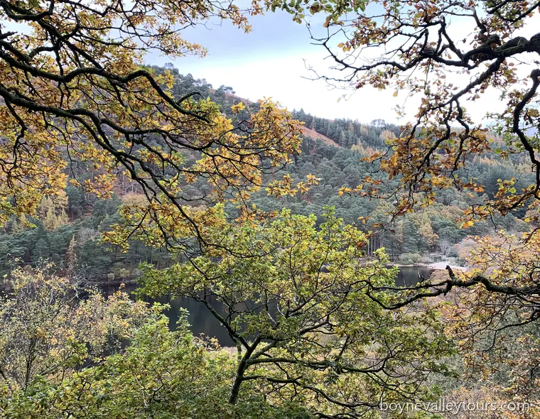
County Wicklow, often called the Garden of Ireland, combines mountains, lakes, monastic valleys and landscaped estates within easy reach of Dublin. Glendalough, with its early Christian monastery and lakes, is among the county's best-known heritage landscapes.
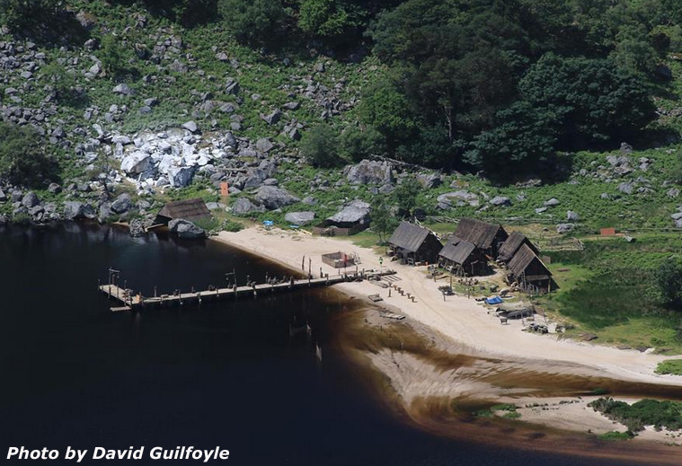 Lough Tay was used as a filming location for the television series Vikings
- Known as the “Garden of Ireland”. County Wicklow is famed for its scenic beauty, combining mountains, glens, lakes, rivers, and landscaped estates, and is widely regarded as one of Ireland’s most scenic regions.
- The Wicklow Mountains dominate the landscape. The Wicklow Mountains form the largest continuous upland area in Ireland and are protected as Wicklow Mountains National Park, offering dramatic scenery, walking routes, and panoramic views.
- Sally Gap and the Military Road. The Military Road was constructed after the 1798 Rebellion to control the mountains, passing through the Sally Gap, one of the most striking high mountain passes in Ireland.
- Glencree and layered modern history. Glencree served as a military barracks, later a reformatory school, a refugee centre for German children after World War II, and today is an internationally recognised centre for peace and reconciliation.
- Lough Tay, the “Guinness Lake”. Lough Tay lies dramatically below the cliffs of Luggala and is often called the Guinness Lake due to its dark waters and pale sandy shore, with strong visual links to the Guinness family estate.
- Film and television landscapes. Wicklow has featured in numerous productions, including Vikings at Lough Tay and the romantic film location known as the P.S. I Love You bridge, reinforcing its reputation as Ireland’s “Hollywood”.
- Glendalough, a major early Christian site. Founded in the 6th century by St. Kevin, Glendalough became one of Ireland’s most important monastic settlements and remains a place of pilgrimage, archaeology, and natural beauty.
- Iconic monastic architecture at Glendalough. The site includes a well-preserved round tower, early stone churches, St. Kevin’s Church or “Kitchen”, crosses, gateways, and a cathedral dating mainly from the 10th to 12th centuries.
- Powerscourt Estate and Gardens. Powerscourt began as a medieval castle before evolving into a grand Palladian mansion in the 18th century, surrounded by internationally renowned gardens and views towards the Sugar Loaf.
- Avoca and Ireland’s textile heritage. Avoca is home to Avoca Woollen Mills, one of the oldest continuously operating woollen mills in the world, representing Wicklow’s long tradition of craft, industry, and rural life.
 County Wicklow landscape
Historic and Scenic Highlights of County Wicklow
Glencree
- Survivors of the 1798 Rebellion sought refuge in the surrounding mountains.
- Construction of the Military Road began in 1800.
- Glencree Barracks was designed to accommodate a captain and 100 soldiers.
- The Oblates of Mary Immaculate (OMI) established St. Kevin’s Reformatory School here in 1858 and rebuilt the property to house more than 300 boys. The reformatory closed in 1940.
- From 1945 to 1950, following the end of World War II, Glencree operated as a refugee centre for German children under the auspices of the Irish Red Cross.
- Since 1974, Glencree has been engaged in practical peacebuilding and reconciliation work in Ireland and, more recently, internationally.
Glendalough
- Founded in the 6th century by St. Kevin.
- Following the Anglo-Norman invasion, ecclesiastical authority moved to Dublin in 1214, and the Diocese of Glendalough was absorbed into the Diocese of Dublin.
- The destruction of Glendalough by English forces in 1398 left the settlement largely in ruins, though it continued as a local church and place of pilgrimage.
- The surviving ruins mainly date from the 10th to the 12th centuries.
- The Gateway was originally two storeys high and featured two fine granite arches.
- The cross-inscribed stone marked the sanctuary boundary, denoting the area of refuge.
-
The Round Tower
- Built of mica-slate interspersed with granite and standing approximately 100 feet (30 metres) high.
- The conical roof was rebuilt in 1876 using the original stones.
- The tower originally contained six timber floors connected by ladders.
- The four storeys above entrance level are each lit by a single window, while the top storey has four windows aligned with the cardinal compass points.
-
The Cathedral
- The large mica-slate stones visible up to the height of the square-headed west doorway were reused from an earlier, smaller church.
- The chancel and sacristy date from the late 12th century.
- St. Kevin’s Cross, an early granite cross with an unpierced ring.
-
St. Kevin’s Church or “Kitchen”
- The steep roof, formed of overlapping stones, is supported internally by a semi-circular vault.
- Access to the croft or roof chamber was through a rectangular opening towards the western end of the vault.
- The church also featured a timber first floor.
- The belfry, with its conical cap and four small windows, rises from the west end of the stone roof in the form of a miniature round tower.
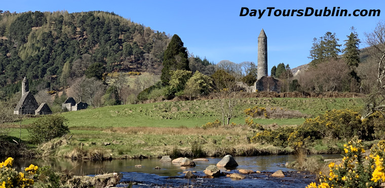 Glendalough, County Wicklow, with its early medieval round tower and monastic ruins
Powerscourt
- Originally a 13th century medieval castle, owned by the Le Power family, from which the name “Powerscourt” is derived.
- In 1603, Richard Wingfield was granted Powerscourt Castle and its lands by Queen Elizabeth I as a reward for his military service.
- In 1730, the Viscount Powerscourt commissioned the architect Richard Castle to design Powerscourt House, a 68 room mansion completed in 1741.
- The mansion was designed around the medieval castle in the Palladian style, inspired by the formal classical architecture of ancient Greece and Rome.
- In November 1974, a fire caused extensive damage to Powerscourt House.
Kilmacurragh Botanic Gardens
- Kilmacurragh is a satellite of the National Botanic Gardens of Ireland, set on a historic estate in County Wicklow and known especially for its rhododendrons, conifers and rare trees.
- The estate developed around Kilmacurragh House, associated with the Acton family from the late 17th century, with the gardens transformed in the mid 19th century by Thomas Acton and his sister Janet.
- Working with David Moore and later Sir Frederick Moore, curators of the National Botanic Gardens at Glasnevin, the Actons introduced many exotic plants that thrived in Wicklow’s milder climate and acid soils.
- Kilmacurragh became home to an outstanding Himalayan rhododendron collection, including plants linked to 19th century plant-hunting expeditions, and today holds a nationally important rhododendron collection.
- The Broad Walk, planted in the early 1870s with Irish yews and flowering rhododendrons, is one of the garden’s best-known features, especially in spring when fallen blossom carpets the path.
- After a long period of decline in the 20th century, the gardens came into State care and were formally linked to the National Botanic Gardens in 1996, with major restoration continuing since then.
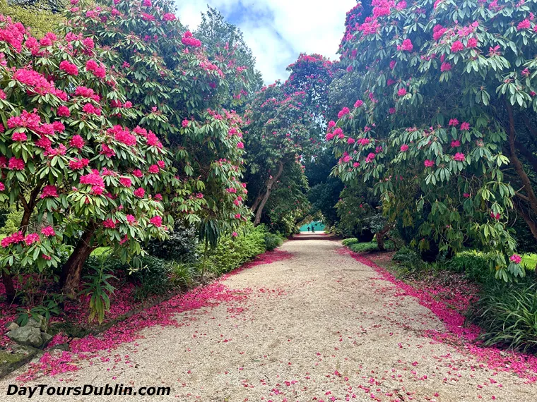 Rhododendrons in bloom at Kilmacurragh Botanic Gardens in Wicklow
Athgreany Stone Circle
- Áth Gréine, meaning “Field of the Sun”.
- A stone circle of 14 granite stones dating to the late Bronze Age (1400–500 BCE).
- Locally known as the Piper’s Stones, measuring approximately 23 metres in diameter.
- An outlier stone, known as the Piper, stands about 30 metres to the north-east.
- According to local legend, the dancers and the piper were turned to stone for dancing on the Sabbath.
Castleruddery Stone Circle
- Dating from the late Bronze Age (1400–500 BCE).
- An embanked stone circle consisting of 40 stones, measuring approximately 30 metres in diameter.
- Two white quartz portal stones, each weighing around 15 tonnes.
- Surrounded by an earthen bank approximately 1.2 metres high.